Industries We Serve

Industries We Serve

MEEG provides a variety of services to a broad range of industries.

Scroll to Learn More


Construction

Laser Scanning

What We Do

MEEG offers 3D laser scanning, point cloud production to 3D BIM modeling services, with extensive experience in construction industries to assist you in achieving efficiency and minimize risks to your project during planning, design, execution and operational phases.

Using 3D laser scanning technology, we can deliver a digital representation of the existing construction environment in the format of 3D point cloud, Panoramic images, as-built 2D drawings (plans, sections and elevations) and 3D CAD models which is definitely Scan to BIM.

We deliver our BIM models with the maximum level of detail (LOD) we can reached from the 3D laser scanning process at the site with the level of information (LOI) requested from our clients.

Benefits

Fast and comprehensive data

Detailed survey, with a very small risk of error, thus, the requirement of re-visiting the site is eliminated

Ease of data sharing

Common Deliverables

Pointcloud representing the scanned area

As-Built 2D drawings (plans, elevations and sections)

Fly-through or walkthrough videos

VR walkthrough

Panoramic images

As-Built BIM models

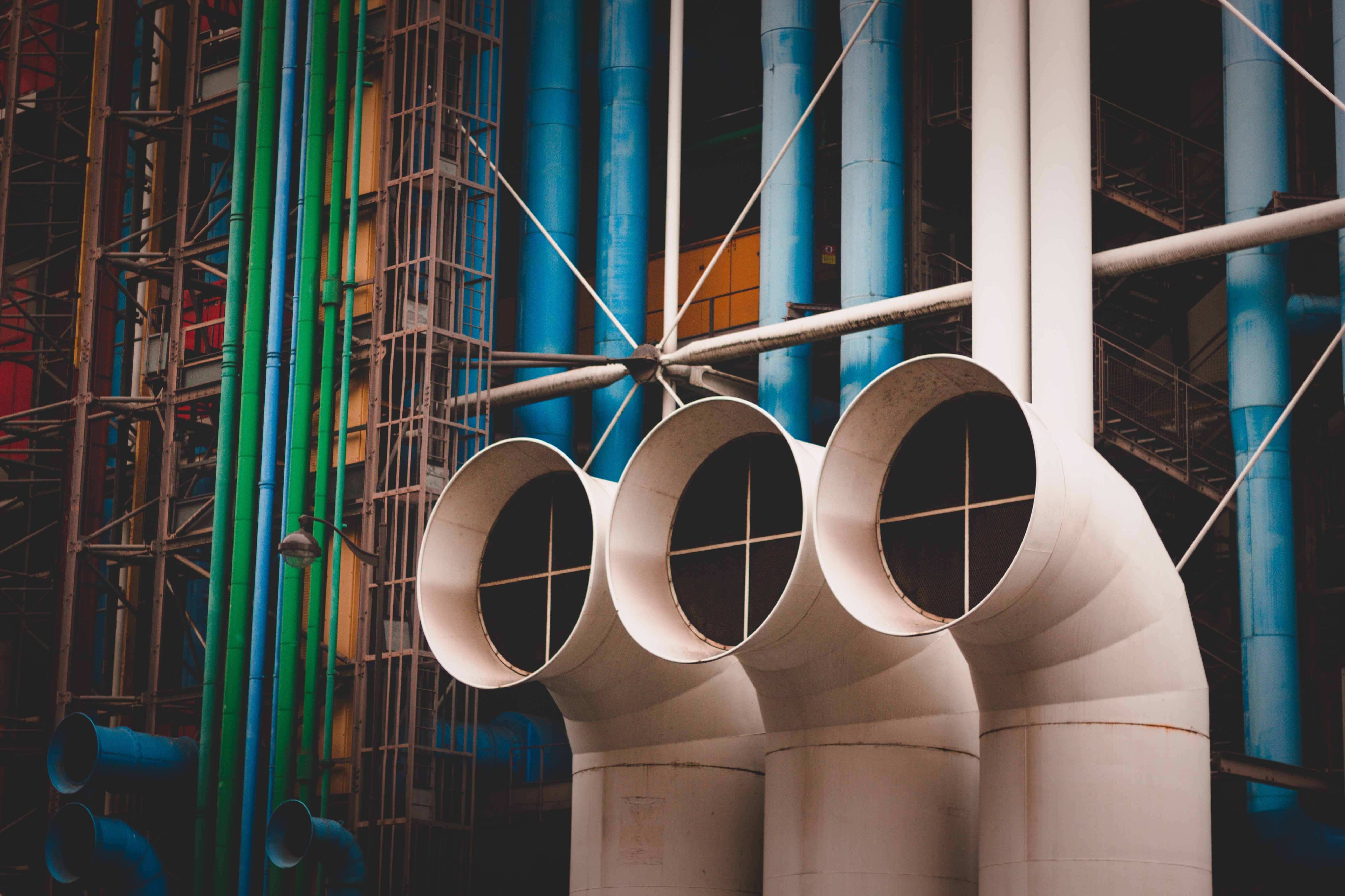
Industrial Applications

What We Do

Our high-density 3D laser scanning techniques helps our clients achieve the requirement they are looking for Building Information Model (BIM) for their plants. Our team can translate the as-built captured pointcloud data into millimeter-accurate as-built 2D drawings and 3D CAD models.

Our high-density 3D laser scanning techniques helps our clients achieve the requirement they are looking for Building Information Model (BIM) for their plants. Our team can translate the as-built captured pointcloud data into millimeter-accurate as-built 2D drawings and 3D CAD models.

MEEG generates Intelligent 3D as-Built models at any level of detail as per your needs according to the highest of industry standards.all asset data can be added to the created intelligent 3D model, such as access points, asset tags, and all P&IDs data and specs

MEEG generates Intelligent 3D as-Built models at any level of detail as per your needs according to the highest of industry standards.all asset data can be added to the created intelligent 3D model, such as access points, asset tags, and all P&IDs data and specs

Our experienced team create and edit the plant P&ID’s, 3D models, and extract piping orthographics and isometrics with industry-specific toolset for plant design

Our experienced team create and edit the plant P&ID’s, 3D models, and extract piping orthographics and isometrics with industry-specific toolset for plant design

Benefits

Ease of data sharing

Fast and comprehensive data, record up to 976k points per second up to a 1mm accuracy

Detailed documentation, with a very small risk of error, thus, the requirement of re-visiting the site is eliminated

Cost & time savings

Allows surveys to be carried out with reduced HSE risk

Time saving and finding better and faster solution for any technical problem.

Better asset utilization.

avoid contact measurement

Common Deliverables

Pointcloud representing the scanned area

Panoramic images

As-Built 2D drawings (plans, elevations and sections)

As-Built Intelligent 3D models

VR walkthrough

Fly-through or walkthrough videos

As-Built P&IDs and PFDs

As-Built ISO drawings

Oil & Gas

What We Do

In Oil & Gas industry MEEG is a market leader in production of real Digital Twin for Oil and Gas brown fields in Egypt, Our team has extensive experience dealing with upstream, midstream and downstream facilities.

In Oil & Gas industry MEEG is a market leader in production of real Digital Twin for Oil and Gas brown fields in Egypt, Our team has extensive experience dealing with upstream, midstream and downstream facilities.

Our experienced team also creates and edit the plant P&ID’s and PFDs which provides you with updated documentation representing the as built site condition taking in consideration all changes may be done in the process

Our experienced team also creates and edit the plant P&ID’s and PFDs which provides you with updated documentation representing the as built site condition taking in consideration all changes may be done in the process

The integration between the data collected from the facility using 3D laser scanning and one on one site verification and done by our teams enables us to generate 3D As Built models to which pertinent documentation and information can be added, such as access points, asset tags, and P&IDs data. The intelligent 3D model is the basis for many of the facility’s workings in ongoing engineering projects, maintenance and operation. With such intelligent 3D model supported with database we automatically generate piping orthographics and isometrics and other derivatives (line lists, valve lists , etc) with industry-specific toolset for plant design.

The integration between the data collected from the facility using 3D laser scanning and one on one site verification and done by our teams enables us to generate 3D As Built models to which pertinent documentation and information can be added, such as access points, asset tags, and P&IDs data. The intelligent 3D model is the basis for many of the facility’s workings in ongoing engineering projects, maintenance and operation. With such intelligent 3D model supported with database we automatically generate piping orthographics and isometrics and other derivatives (line lists, valve lists , etc) with industry-specific toolset for plant design.

Utilizing our huge experience in research and development R&D, we come up with solutions take our 3D models with all engineering data to virtual reality mode. Using this VR solutions, adding new values to your data and ensure its sustainability as it can be used for training, giving an ease access to the decision makers at your organization which lead to better asset management.

Utilizing our huge experience in research and development R&D, we come up with solutions take our 3D models with all engineering data to virtual reality mode. Using this VR solutions, adding new values to your data and ensure its sustainability as it can be used for training, giving an ease access to the decision makers at your organization which lead to better asset management.

Benefits

Ease of data sharing

Fast and comprehensive data, record up to 976k points per second up to a 1mm accuracy

Detailed documentation, with a very small risk of error, thus, the requirement of re-visiting the site is eliminated

Allows surveys to be carried out with reduced HSE risk

Time & cost savings

Better asset management based on real data

Eliminate Change Orders and Ensure Accuracy of Prefabricated Materials.

No shutdown is needed as there is no contact measurement.

Common Deliverables

Registered Pointcloud representing the scanned area

As-Built Intelligent 3D models

As-Built P&IDs and PFDs

Panoramic images

VR walkthrough

As-Built ISO drawings

As-Built 2D drawings (plans, elevations and sections)

Fly-through or walkthrough videos

Heritage

Heritage

With a very strong experience in 3D laser scanning and pointcloud production , our team captures the accurately the details of complex features for several historical landmarks and deliver that to our clients in precise formats better than ever.

With a very strong experience in 3D laser scanning and pointcloud production , our team captures the accurately the details of complex features for several historical landmarks and deliver that to our clients in precise formats better than ever.

The colored point cloud data is the first step in your digitalization journey which can include but not limited to the following derivates 2D drawings, BIM models with high level of detail, photographic documentary, better visualization and virtual tours.

The colored point cloud data is the first step in your digitalization journey which can include but not limited to the following derivates 2D drawings, BIM models with high level of detail, photographic documentary, better visualization and virtual tours.

Benefits

Visualization

Visualization

Visualization

Digital documentation for historical sites

Digital documentation for historical sites

Digital documentation for historical sites

Ease of data sharing

Ease of data sharing

Ease of data sharing

Fast and comprehensive data

Fast and comprehensive data

Fast and comprehensive data

Detailed documentation,

Detailed documentation,

Detailed documentation,

Common Deliverables

Pointcloud representing the scanned area

As-Built 2D drawings (plans, elevations and sections)

As-Built BIM models

Fly-through or walkthrough videos

VR walkthrough

Panoramic images

Interior Design

Interior Design

When it comes to architectures a massive number of details related to each feature at the site so the accuracy of data collection by 3D laser scanning or 3D cameras offers a wide range of as built deliverables based on your projects needs from panoramic images, virtual tours, 2D drawings with all architecture details to real BIM models

When it comes to architectures a massive number of details related to each feature at the site so the accuracy of data collection by 3D laser scanning or 3D cameras offers a wide range of as built deliverables based on your projects needs from panoramic images, virtual tours, 2D drawings with all architecture details to real BIM models

Utilizing our huge experience in research and development R&D we come up with on time virtual editing to your model features which save your engineering team time and achieve more reality to your deliverables

Utilizing our huge experience in research and development R&D we come up with on time virtual editing to your model features which save your engineering team time and achieve more reality to your deliverables

Benefits

Visualization

Ease of data sharing

Fast and comprehensive data

Detailed documentation, with a very small risk of error, thus, the requirement of re-visiting the site is eliminated

Common Deliverables

Pointcloud representing the scanned area

Panoramic images

As-Built 2D drawings (plans, elevations and sections)

VR walkthrough

As-Built BIM models

Fly-through or walkthrough videos


Transportation and Railways

Laser Scanning

In transportation and railways industries digital transformation solutions became a common and essential part of all engineering activities starting from planning and design, during construction also in operation of the facilities. Scan to BIM capture a large amount of data and after digitizing it to BIM model, it became easier to edit and develop minimizing the effort of collecting data using traditional techniques, the way to share the data with different disciplines and the time to perform your modifications or extension.

In such industries where we have sometimes more complex areas e.g. Intersections or rails connections the planning of site work procedure and data collection methodology is our team edge with major experience built through our projects.

Our portfolio in transportation and railway ranges from data capture, 2D drawings, GIS databases, deformation monitoring for different features within the area and BIM models.
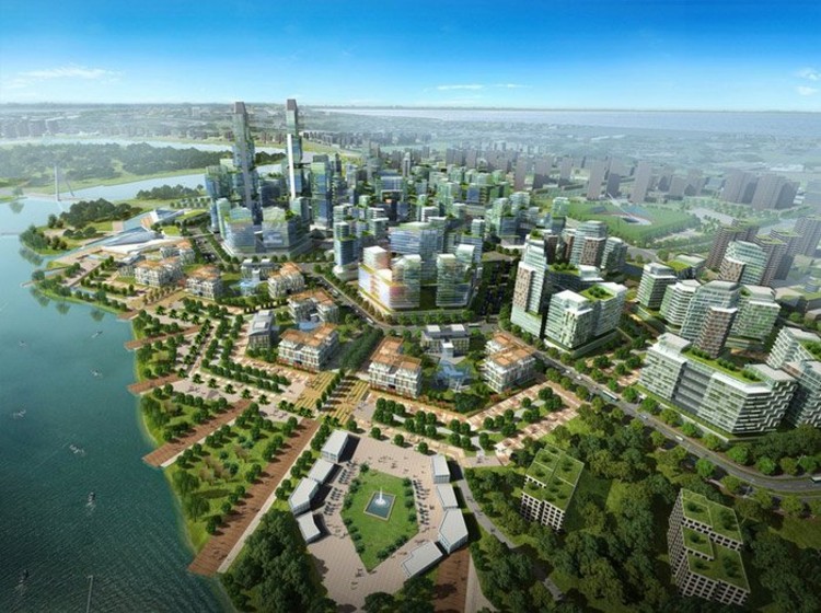
Urban Documentation

Urban Documentation

MEEG has experience in data capturing and has provided cost effective and high-quality services for many clients. MEEG have worked on multiple projects around the world and has created maps of a large-scale data using 3D laser scanning technology in both terrestrial and mobile modes as well as satellite imagery, georeferencing tools to create an easy-to-use map.

MEEG has experience in data capturing and has provided cost effective and high-quality services for many clients. MEEG have worked on multiple projects around the world and has created maps of a large-scale data using 3D laser scanning technology in both terrestrial and mobile modes as well as satellite imagery, georeferencing tools to create an easy-to-use map.

The data collected from the site and after per and post processing can lead to accurate products such as 2D and 3D topographic maps, digital models also GIS database can be produced.

The data collected from the site and after per and post processing can lead to accurate products such as 2D and 3D topographic maps, digital models also GIS database can be produced.

Smart Cities

MEEG services provide intelligent, connected Smart modelling for Capital Asset Management (CAM) of existing and new facilities. Engineering-grade 3D models are created using state of the art laser scanning and image-based sensors. Information collected from other sensors in other dimensions is then integrated into the 3D model to provide high rate, real-time data analytics through Internet of Things (IoT) systems. This assists with the management of buildings, facilities, structures, plants and more. Massive savings in maintenance and operations costs are introduced. Our services maintain asset values, mitigate risks, and maximize ROI to all stakeholders.

MEEG services provide intelligent, connected Smart modelling for Capital Asset Management (CAM) of existing and new facilities. Engineering-grade 3D models are created using state of the art laser scanning and image-based sensors. Information collected from other sensors in other dimensions is then integrated into the 3D model to provide high rate, real-time data analytics through Internet of Things (IoT) systems. This assists with the management of buildings, facilities, structures, plants and more. Massive savings in maintenance and operations costs are introduced. Our services maintain asset values, mitigate risks, and maximize ROI to all stakeholders.

Utilizing our experience in data capture, R&D, 2D and 3D modelling and database construction we are able to contribute in building some solutions serving smart city objectives.

Utilizing our experience in data capture, R&D, 2D and 3D modelling and database construction we are able to contribute in building some solutions serving smart city objectives.